Introduction:
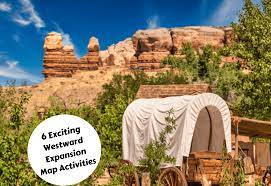
The Westward Expansion in the United States during the 19th century was a crucial period in American history, marked by significant events such as the Louisiana Purchase, the Oregon Trail, and the California Gold Rush. Studying this era can be highly engaging with hands-on activities that not only educate but also capture students’ imagination. Here are six exciting Westward Expansion map activities that will make learning about this important time both fun and interactive.
1. Create Your Own Map of Westward Expansion Territories
Have students research the territories acquired during Westward Expansion and use a blank map of the United States to draw and label each territory. This activity gives students a visual representation of how much land was acquired and allows them to learn about different areas’ features.
2. Design a Lewis and Clark Expedition Map
Encourage students to examine maps from the Lewis and Clark Expedition and recreate their journey using various routes, rivers, landmarks, and Native American tribes’ territories. By drawing the expedition’s route, students gain an understanding of the geographical challenges faced by explorers at that time.
3. Build a 3D Oregon Trail Map
Using craft materials like foam blocks, pipe cleaners, and cardboard, have students create a three-dimensional map illustrating important milestones along the Oregon Trail. This hands-on activity engages learners while teaching them about geographic features such as mountains, valleys, rivers, and deserts encountered by pioneers on their westward journey.
4. Gold Rush Route Map Puzzle
Create a jigsaw puzzle with pieces that represent key locations related to the California Gold Rush – starting with Sutter’s Mill where gold was discovered and including major gold mines, boomtowns, supply routes, etcetera. By piecing together these various locations, students will better understand how gold miners traveled to seek their fortunes.
5. Comparing Maps Over Time
Provide students with maps of the United States from different periods during the 19th century – such as 1800, 1840, and 1870. Encourage them to compare and contrast these maps while observing changes in state borders, population growth or contraction, the presence of railroads, and territorial acquisitions. This helps build students’ spatial thinking skills and grasps the shifting American landscape during Westward Expansion.
6. Interactive Westward Expansion Map Game
Create a digital map game that allows students to learn about various events, geographical features, and key figures of Westward Expansion through an interactive platform. Students could earn points and progress by answering questions about specific territories or events and ultimately accumulate enough knowledge to reach the western coast.
Conclusion:
Map activities are an engaging way to teach students about historical events while developing their geographical awareness. These six exciting Westward Expansion map activities challenge students to think critically about this era of American history, apply their creativity, and immerse themselves in the learning process.


