Introduction:
Sexual exploitation has been a long-standing issue, plaguing societies around the world for centuries. In recent years, however, the problem has gained momentum and continues to spiral out of control. This article will discuss the growing problem of sexual exploitation in our world today, its impact on victims and communities, and what steps can be taken to combat this heinous crime.
Defining Sexual Exploitation:
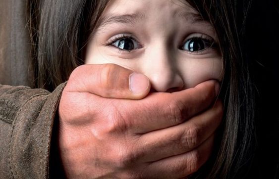
Sexual exploitation is a form of sexual abuse that involves manipulating or coercing someone into engaging in sexual activity against their will. It may include acts such as sex trafficking, forced prostitution, production and distribution of child pornography, and online enticement for sexual purposes. Sexual exploitation violates the victim’s fundamental human rights, dignity, and freedom.
Growing Problem:
Despite global efforts to combat it, sexual exploitation remains a pervasive issue across all continents. Factors such as poverty, economic instability, political unrest, and a lack of education create conditions ripe for sexual exploitation to thrive. These circumstances are further exacerbated by rapid advancements in technology and the resulting increase in online activities.
The proliferation of the internet provides exploiters with virtual access to potential victims from any corner of the globe. Social media platforms are particularly vulnerable spaces where exploiters can groom vulnerable individuals for exploitation purposes. The anonymity afforded by these digital spaces empowers perpetrators further.
Impact on Victims and Communities:
Emotional, psychological, and physical trauma marks the lives of those subjected to sexual exploitation. Victims often experience lasting feelings of shame, depression, anxiety disorders, post-traumatic stress disorder (PTSD), and even suicidal ideation. The consequences extend beyond individual suffering; communities suffer as well when crimes go unnoticed or unaddressed, allowing for these destructive behaviors to persist.
Moreover, sexual exploitation has profound social consequences like perpetuation of gender inequality and normalization of violence against women and children. It also contributes significantly to the global economy’s dark side, with human trafficking estimated to be the third-largest organized criminal industry.
Combatting Sexual Exploitation:
Combating sexual exploitation requires concerted efforts from governments, non-governmental organizations, and society as a whole. Addressing root causes like poverty and lack of education is essential for alleviating vulnerability to exploitation. Strengthening legislation and enforcing harsh penalties against perpetrators will deter potential exploiters and dismantle criminal networks.
Public awareness campaigns are vital to educate communities about the dangers of sexual exploitation and how to identify signs of grooming or coercion. Ensuring open channels for reporting suspicious behavior and providing safe spaces for victims to seek help are crucial.
The role of technology cannot be overstated in both facilitating exploitation and combatting it. Tech companies must work together with law enforcement agencies to monitor online spaces closely and develop tools that help identify and block explicit content or predatory behavior.
Conclusion:
Sexual exploitation is a complex issue that demands immediate attention from all quarters. By understanding the scope, scale, and impact of the problem, societies can work together to create lasting solutions that protect innocent lives from suffering at the hands of exploiters. Fostering a culture of empathy, understanding, and vigilance is vital in our collective fight against this growing global problem.